The Tesla Club Italy Revolution event is one of the key happenings for the Italian e-mobility, and during the 2021 edition, it was possible to see more than 120 Tesla cars from Italy with many fans onboard: an occasion to talk about the world of electric mobility, together with the most important and influential players in the field.
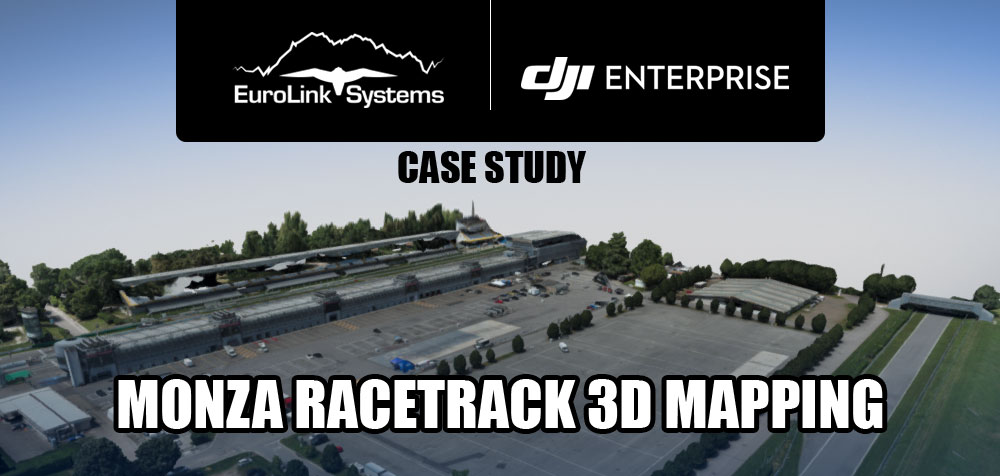
Eurolink Systems was present at the event as main sponsor and DJI Enterprise official dealer and maintenance/repair center. In addition to high-resolution aerial shots, the capabilities of DJI Matrice 300 and DJI Zenmuse P1 payload were used to map the famous Monza Racetrack.
Flight planning and config
DJI’s Matrice 300 RTK was equipped with the DJI Zenmuse P1 payload with 35mm focal length at 55 meters using the innovative smart oblique flight. In this powerful mode, the P1’s gimbal automatically rotates and captures five different images from five different angles while flying along its predetermined flight path. Theoretical GSD in the nadiral flight, is 0.69cm/pixel and the 0.84cm/pixel with 55 degrees tilt. A full flight takes 79 minutes that means at least two different take off and landing. Thanks to the rapid battery change introduced by DJI, without turning off the systems, dead time are reduced to a minimum.

Camera shutter allows up to 7.5m/s at 55m ad we have chosen this maximum speed without any blurry effect. That is a proof of the exceptional system quality. Target to surface take-off point remained to zero because we needed to reconstruct buildings and ground. Furthermore, using oblique shoots, we catched a lot of images that can be used to keep the right overlap.

The following images shown the overlap configuration in the oblique path.

RTK correction was provided by GNSS Lombardia-Piemonte-Valle d’Aosta by using NTRIP protocol. The Service, as in many other regions is free and only an online registration is required to obtain the credentials.
For a better accuracy we utilized as mountpoint MAX_RTCM3 thanks to master and slave permanent stations.

We managed to obtain a FIX position solution with centimetre accuracy in less than one minute and we were ready to arm immediately.
Results and post processing
The third parts software as the Russian Metashape is fully compatible with the RTK features. By flagging all the import/export feature, photo’s metadata containing accuracy, is detected and used to estimate the camera location during alignment process.


The three oblique flights obtained, seem like a crosshatch flight with quite impressive results thanks to a sub-1cm ground sample distance (GSD) from 50 metres. That means a very expeditive survey with a lot of small details. The Smart Oblique Capture mode captured vertical and oblique data in a single flight – enhancing efficiency and creating a more robust data set without needing to manually capture additional oblique imagery. 2154 images were taken for a large 9 hectares survey. No particular noise was detected after the alignment: just some refinements were needed to expedite the dense point cloud generation.
A very dense cloud (more than 340 million points) due to high end camera resolution was generated.
Trees were perfectly reconstructed, but we couldn’t say the same for standings. To enhance the quality of this data set, manual imagery should be collected, for filling in the gaps missed by the drone.

In the images above we can also observe a ghost effect generated by the cars on the starting grid. Unfortunately, during the flights, cars come into the track from the paddock to celebrate the anniversary. This issue isn’t solvable in the 3d model but only in drawing a polygon in the ortho images.


The use of arbitrary meshing method (Poisson) for very dense clouds might result in an index overflow. Using the new “deep maps” as source data, we created the mesh without problems. Generally, when using “mosaic” as blending mode, artifacts and unreal models were produced. For this reason, is preferable to use “average” method as blending mode. In this case the best result was achieved with a “mosaic” blending mode
The incredible photographic result is shown by the orthomosaic. The GSD at the end of the process was 0.719cm/pixel. Once again, look at the details how they remain sharp while zooming in: thanks to the sub-1cm GSD, the quality is so high that you can clearly detect many cracks on the white road marking strip.